

Via Gust MEES
Get Started for FREE
Sign up with Facebook Sign up with X
I don't have a Facebook or a X account


 Your new post is loading...
 Your new post is loading...
Your new post is loading...


Carol Zuegner's curator insight,
April 28, 2014 10:28 AM
This is a tool and a practice I want to do more with. Maybe with the backpack in Alaska.

Make maps on your iPhone. Click2Map Mobile helps you create and manage advanced online maps from your iPhone and iPad. Click2Map Mobile is a free application allowing you to consult, update, create and manage all your maps from any location. Via Gust MEES

Gust MEES's curator insight,
January 16, 2013 3:57 AM
Great Tool with lots of possibilities! Exists also as app for iPhone, iPad and Android! AND also possibility to host the created maps on their server!
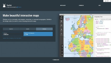
Design beautiful maps...
Make beautiful interactive maps
TileMill is an open source project by MapBox...
Read more:
Via Gust MEES

Suggestion of a few tools with which you can get your students mapping!
1. Create an animated “flightpath” of a journey with Tripline 2. Add voice recording to a map with Map Maker and Vocaroo 3. Record and share your impressions of different places with Woices
Read more... Via Gust MEES, Antonios Bouris
|
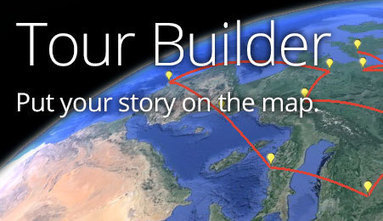

Massimiliano Cammuso's curator insight,
November 20, 2013 9:03 AM
Tour Builder - Put your story on the map. Google has launched the beta of TOUR BUILDER a mix of his various experiment such as City Tours. This time it seems that they are focusing on storytelling, infact you can easly add on a placemark videos, photo and other content and then their payoff is "Put your story on the map". In difference and unfortunately, with Tour Building I was unable to create a walking path, then the tour that I designed was not so precise. Have you already tried? Do you have any feedback on this new product of Google?

From
mashable

Ever wonder what it would look like to plot every single geotagged tweet since 2009 on a map? Twitter has done just that.
Twitter posted these maps of Europe, New York City, Tokyo and Istanbul on its blog Friday. They use billions of geotagged tweets: Every dot represents a tweet, with the brighter colors showing a higher concentration of tweets. It's pretty amazing how the mapped-out tweets clearly match with population centers, highways and the like — though perhaps that's obvious. Via Lauren Moss, Neil Ferree

Miles Gibson's curator insight,
October 5, 2014 9:41 PM
Unit 1 Nature and Perspectives of Geography. This is a map of all of the geotagged twitter posts from 2009 to now in the United States. Its shows population distribution and points of interest that people like to travel to. It shows dense population centers and highways. You can see the roads in the map because of space in the map not covered. The brighter colors are in higher population and more popular travel destinations. This is a map of many types. This map is a part of unit 1 because it is a map of a basic geographic concept. This map is a functional map of sorts because it shows points of travel that people go to, but it is not varied by distance so it is not a precise version. This map is a definite example of a thematic map because it shows the story of the travel destinations of five years of their lives.
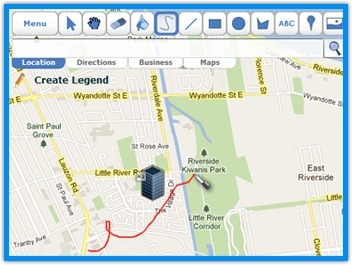
Draw on google maps with scribbles, squares, circles, and more!
he Easiest Way to Draw and Share Maps!
- Add Custom Images / Overlays
Read more:
Via Gust MEES
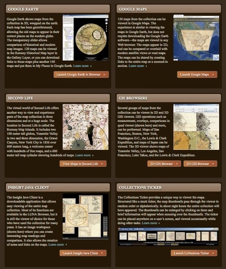
Robin Good: The David Ramsey Map Collection is an historical collection of thousands of beautiful maps and atlases organized and made freely accessible to the public online in unique and unprecedented ways.
This online collection offers in fact no less than 12 different ways to navigate its contents by providing dedicated browsers and visual imaging tools ranging from 2D-GIS to SecondLife and virtual QTR panoramas. For example, with the Google Earth visualization, any map in the collection can be seen perfectly mapped on the globe, or by using the Luna Browser one can create collections, save and download images, annotate maps or even create embeddable presentations. This is truly a spectacular collection with marvellous maps and atlases enriched by complementary data, visualization tools and a formidable array of navigation devices.
Possibly the best online curated collection I have seen so far.
Must-see. 10/10
About page: http://www.davidrumsey.com/about
Collection and Tools to navigate it: http://www.davidrumsey.com/view
Home page: http://www.davidrumsey.com/
Via Robin Good
|


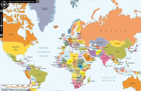
World Interactive Map
Saving this for my Social Studies classes ;)
Fantástico mapa interactivo muy útil para trabajo en aula.